
Dong Nai has an opportunity to restructure its urban space through large-scale projects and developments with far-reaching impacts. However, building more roads, developing more urban areas or constructing more modern facilities does not necessarily create a modern city. The deciding factors are the vision, the way space is organized and the development mindset behind each project.
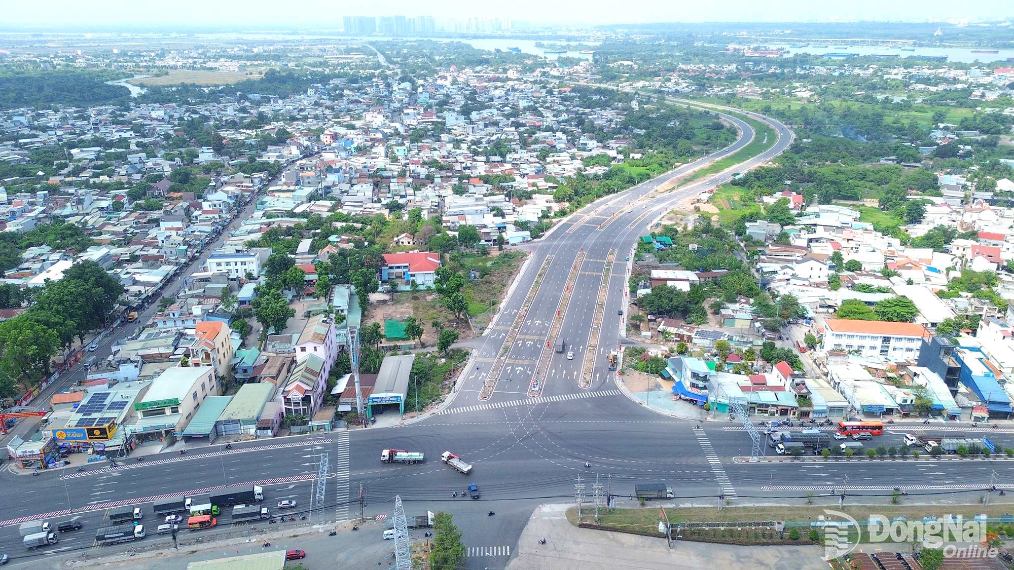 |
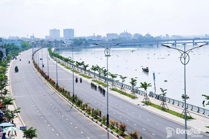
| Nguyen Huu Canh Boulevard in Long Hung Ward. |
Politburo Resolution No. 16-NQ/TW on building and developing Dong Nai City through 2035, with a vision to 2065, has opened up a new vision for the city. To turn the orientations and vision set out in the resolution into reality, the first thing that needs to change is the approach to organizing development space, allowing infrastructure to lead development and gradually shape a city with a high quality of life.
Restructuring development space
For a long time, urbanization in Dong Nai and many other localities followed a pattern in which urban areas expanded as populations grew, more roads were built as travel demand increased, and more residential areas were developed as housing needs rose. This approach addressed immediate needs and generated rapid growth momentum, but it also brought a number of consequences, including sprawling urban development, social infrastructure failing to keep pace, increasing pressure on transport systems and a shortage of public spaces for residents.
The situation in Trang Dai Ward is a clear example. The ward once experienced a period of “rapid” development without adequate coordination, leaving problems related to infrastructure, construction, education, healthcare and spatial organization. The city subsequently held numerous working sessions and surveys to identify solutions for restructuring the locality’s development space. The area has gradually been reorganized through investment in new, upgraded and expanded roads; construction of additional schools; tighter management of land use and construction order; and relocation of facilities that were no longer appropriate, such as waste dumps and livestock farms.
Resolution No. 16 sets out a planning approach that goes beyond simply allocating land by function, aiming instead to organize development corridors and growth poles capable of strengthening regional connectivity. Through this approach, the urban economy can be connected with aviation, seaports, logistics, industry, agriculture, tourism and services. In other words, the urban spatial structure must be placed within an integrated framework of projects, resources and advantages to maximize their value.
As Dong Nai implements a series of strategic infrastructure projects, restructuring the city’s overall spatial framework has become even more important. When roads, railway stations and urban areas become links in a unified structure, these projects can serve as drivers of development throughout the surrounding areas.
The ongoing Nguyen Huu Canh Boulevard project is a case in point. According to Nguyen Tuan Anh, Member of the City Party Committee’s Standing Board, Vice Chairman of the City People’s Committee, the project is not simply about building a road to facilitate travel and trade; the city also plans to develop the surrounding urban area under a transit-oriented development (TOD) model. Residential, commercial and service, education, healthcare and financial projects will be planned in an integrated manner around the corridor from the outset. The shift from an approach in which “urban development follows infrastructure” to one in which “infrastructure leads urban development” is a crucial step in urban redevelopment. Infrastructure investment must go hand in hand with reorganizing urban space and tapping the added value it generates.
Where cities once tended to turn their backs on rivers, the Dong Nai River should now be viewed as a spatial axis around which the city can be reorganized, different areas connected and public spaces expanded for residents. In line with Resolution No. 16, the river is a strategic spatial axis with an important role in ecology, culture, landscape and urban development. It can also support more effective inland waterway transport, connect growth poles and promote sustainable economic, service and tourism development.
This orientation requires a shift in the development mindset toward creating urban spaces that face the river, expanding public, landscape, ecological, cultural and service spaces to meet residents’ needs for relaxation and recreation. In practice, urban redevelopment is not simply about adding more buildings; more importantly, it is about creating a better spatial structure than before.
Four corridors opening up new development space
The four major corridors identified under Resolution No. 16 are:
- Ho Chi Minh City — Bien Hoa — Long Thanh — Phuoc An Port, focusing on aviation, seaports, logistics and services;
- Bien Hoa — Dau Giay — Tan Phu — Central Highlands, connecting industry, agriculture, ecotourism and energy;
- Phuoc Long — Dong Xoai — Chon Thanh — Hoa Lu — Cambodia — Mainland ASEAN, focusing on border gates, cross-border trade and cross-border logistics;
- Long Thanh — Lam Dong — South Central Coast — Central Highlands, strengthening links among aviation, seaports, the highlands and coastal areas.
Putting people at the center
An urban redevelopment project can be considered successful when residents can live more conveniently and gain better access to schools, hospitals, parks, public transport, housing and employment.
At a meeting in late August 2026, Nguyen Van Ut, Deputy Secretary of the City Party Committee, Chairman of the City People’s Committee, shared his view that projects and developments in the new phase should be assessed not only in terms of investment scale or the effectiveness of individual projects, but, more importantly, by their ability to open up new development space, connect different areas and create more opportunities for residents and businesses. Each project must be placed within the overall planning framework, ensuring coordination between transport and social infrastructure and between urban development, the environment, landscapes and quality of life.
This is also a requirement because the city is implementing numerous major projects simultaneously. If each project is carried out separately, the city may gain more modern facilities without necessarily becoming a modern city. Conversely, when each project is integrated into a unified spatial structure, with connectivity, population distribution, services, the environment and public spaces carefully considered, these projects can collectively create greater value for the city.
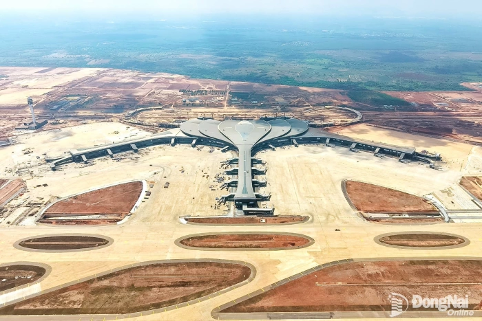
Dong Nai enjoys advantages that few other cities possess. Its urban area covers the largest territory among the country’s cities and has a strategic transport system encompassing all five modes: road, rail, inland waterway, air and sea. It is also home to the country’s largest international airport, which is nearing commercial operation, as well as seaports, international border gates, industrial parks and a clear development orientation under Resolution No. 16. The remaining challenge is to turn these advantages into a high-quality urban structure.
To achieve this, planning thinking must come before individual projects; spatial thinking must come before administrative boundaries; transport infrastructure must precede urbanization; social infrastructure must develop alongside housing; and development must go hand in hand with preservation. Redevelopment does not mean erasing what already exists, but creating a new identity from the values that have already taken shape.
With a history spanning nearly 330 years, abundant land resources and rich cultural, historical and natural assets, the southern region offers Dong Nai many advantages for creating an urban space that is both modern and rich in identity.
This is also one of the important viewpoints established by the Politburo in Resolution No. 16: renew development and planning thinking with a long-term strategic vision and an open spatial development approach; build multidirectional transport infrastructure and a modern, multi-layered, polycentric urban structure; use river systems and natural ecosystems as the primary landscape axes; and develop smart transport systems and smart, green cities that are resilient to climate change.
Perhaps when the way we envision the city changes, the way it is planned, built and operated will change accordingly. This is the foundation for Dong Nai to become a city with a rational development structure, a high quality of life and a distinctive identity. Urban spatial redevelopment, therefore, must first begin with a transformation in thinking.
By Hoang Loc – Translated by Mai Nga, Minho

Thông tin bạn đọc
Đóng Lưu thông tin