
The entire Ben Luc–Long Thanh Expressway, which runs through Ho Chi Minh City, Dong Nai City and Tay Ninh Province, is scheduled to open to traffic simultaneously on September 30.
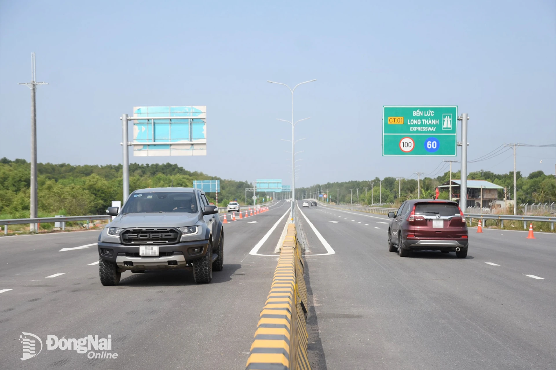 |
| The entire 58-kilometer Ben Luc–Long Thanh Expressway is scheduled to open to traffic on September 30. Photo: Pham Tung. |
Nearly 58 kilometers long, the Ben Luc–Long Thanh Expressway is a key transport artery for connectivity within the Southeastern region, as well as between the Southeastern region and the Southwestern region.
Under the traffic management plan, when the section from Km 0+600 to Km 57+980 opens to traffic, all automobiles will be permitted to use the expressway, except oversized and overweight vehicles. On the section from the expressway's starting point at the interchange with the Ho Chi Minh City–Trung Luong Expressway to the approach road to Binh Khanh Bridge, the maximum speed will be 90 km/h and the minimum speed 60 km/h. From the beginning of Binh Khanh Bridge to the end of the approach road to Phuoc Khanh Bridge, the maximum speed will be 80 km/h and the minimum speed 60 km/h. From the section beyond Phuoc Khanh Bridge to the end of the project, connecting to Tan Hiep Interchange, the maximum speed will be 90 km/h and the minimum speed 60 km/h.
Traffic arrangements at interchanges with National Highways 1 and 50, Nguyen Van Tao Street, Phuoc An Interchange and National Highway 51 have also been specified to ensure smooth access to and exit from the expressway while minimizing traffic conflicts.
The traffic management plan also sets out specific regulations for vehicles crossing Binh Khanh and Phuoc Khanh bridges, the two largest bridges on the Ben Luc–Long Thanh Expressway.
The traffic management plan also sets out specific rules for vehicles traveling across Binh Khanh and Phuoc Khanh bridges, the two largest bridges on the Ben Luc–Long Thanh Expressway. The maximum operating speed on both bridges is 80 km/h, while the minimum is 60 km/h. Vehicles are prohibited from stopping or parking anywhere along the bridges and their approach roads, including in emergency stopping lanes, except in cases of unavoidable technical failure. Stopping to take photographs, check in, admire the scenery or walk on the bridges is also prohibited. Vehicles are also prohibited from reversing or making U-turns on the bridges under any circumstances. In particular, drivers crossing Binh Khanh and Phuoc Khanh bridges must strictly follow instructions from the operating unit or traffic police.
As the two bridges have a navigational clearance of 55 meters, additional operating requirements apply during adverse weather conditions. When crosswinds of level 7–8 are forecast, drivers are advised to reduce their speed to below 60 km/h. If winds reach level 9 or higher, or a severe storm occurs, and authorities order a bridge closure, vehicles must not proceed onto the bridges. Drivers must follow traffic control and diversion instructions to exit onto detour roads or enter rest stops, where they must wait until weather conditions are safe. The traffic management plan also specifies lane arrangements on the bridges.
Under the new traffic arrangements, the interchange connecting the Ben Luc–Long Thanh Expressway with Ho Chi Minh City’s Ring Road 3 cannot yet operate at full capacity because the ring road project has not been completed. Tan Hiep Interchange will also remain closed when the expressway opens on September 30, as the relevant procedures have not yet been completed. As a result, vehicles traveling from Tay Ninh toward Dong Nai will have to exit the Ben Luc–Long Thanh Expressway at the National Highway 51 interchange and continue along National Highway 51. They will not yet be able to connect directly to the Bien Hoa–Vung Tau Expressway.
By Pham Tung – Translated by Mai Nga, Minho




Thông tin bạn đọc
Đóng Lưu thông tin