
On July 21, 2026, the Politburo issued Resolution No. 16 on the construction and development of Dong Nai City through 2035, with a vision to 2065.
For local authorities, the immediate task is to translate the orientations set out in Resolution No. 16 into plans and measures suited to local conditions, while addressing bottlenecks in planning, land and infrastructure to make effective use of available resources for development. In this context, Northern Dong Nai is expected to have more room for growth, thanks to its advantages in land resources, infrastructure and connectivity.
Transport infrastructure opens up new development space
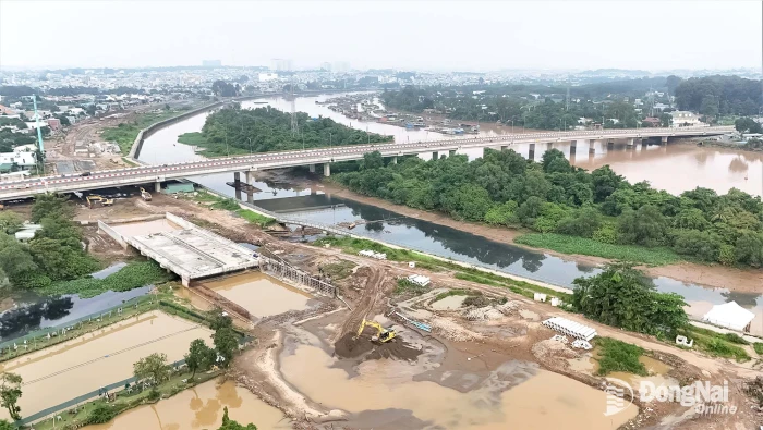
At the construction site of the Ho Chi Minh City - Thu Dau Mot - Chon Thanh Expressway, machinery and workers are being mobilized to build the roadbed, underpasses and drainage systems. The expressway is approximately 52 kilometers long, including a 6.6-kilometer section in Dong Nai, with total investment of more than VND1.4 trillion. Although relatively short, this section is important for directly connecting Chon Thanh with Ho Chi Minh City and the wider Southeastern transport network.
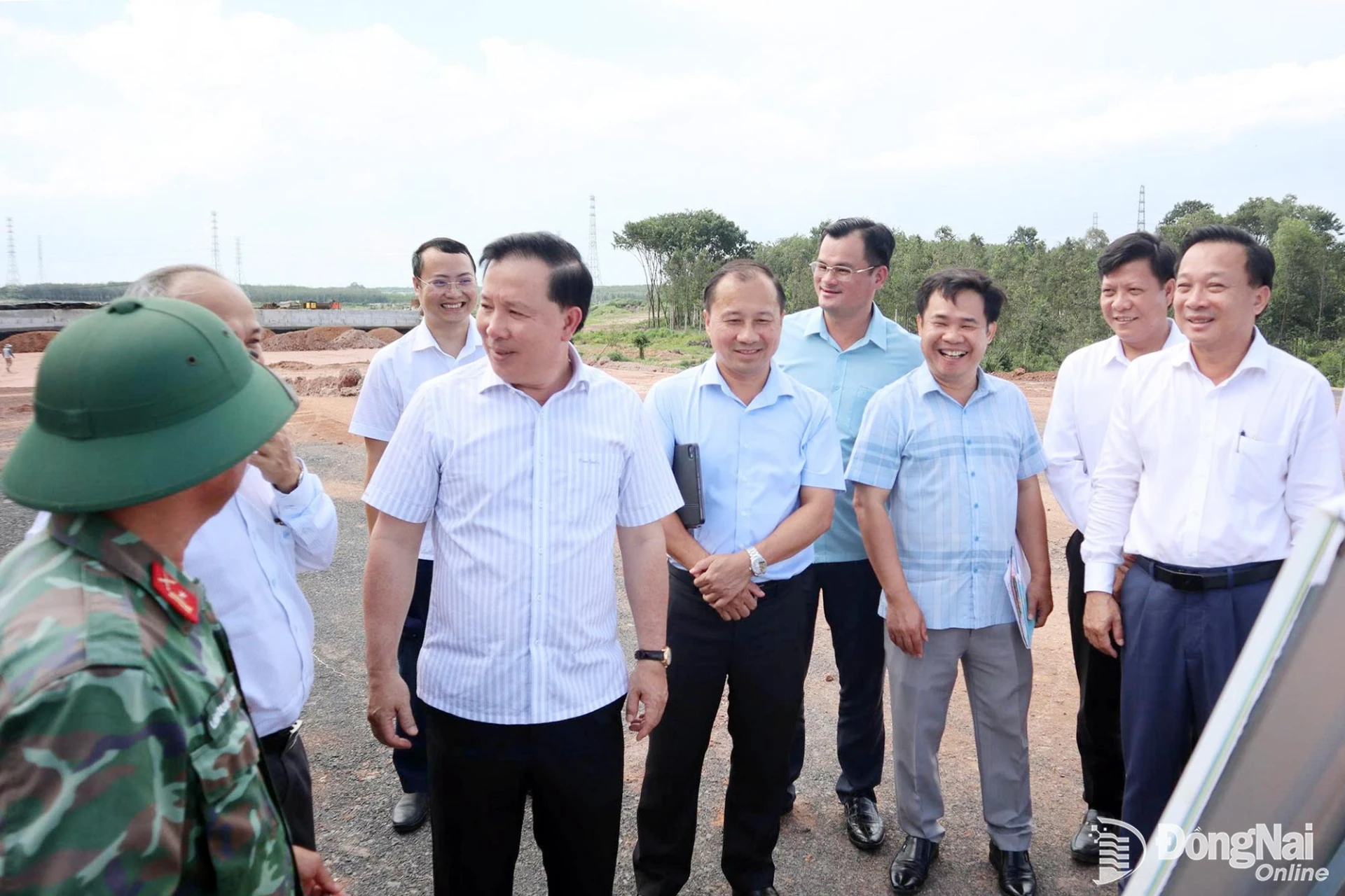 |
| Nguyen Van Ut, Deputy Secretary of the City Party Committee and Chairman of the Dong Nai People's Committee, inspects construction progress on the Ho Chi Minh City - Thu Dau Mot - Chon Thanh Expressway. Photo: Xuan Tuc |
According to information released in August 2026, the contractor had mobilized nearly 90 vehicles and pieces of equipment and hundreds of workers to the construction site, with work volume reaching about 35%. The city aims to basically complete the section in 2026 and put it into operation in 2027. Alongside construction progress, compensation, site clearance and securing construction materials remain key tasks that must be fully addressed to ensure continuous construction and avoid delays.
In another direction, the western section of the North-South Expressway, running from Gia Nghia to Chon Thanh, will form a major transport corridor linking the Central Highlands with the Southeast. Once connected with the Ho Chi Minh City - Thu Dau Mot - Chon Thanh Expressway, the network will bring the northern part of the city into the interregional transport system, providing access to ring roads, industrial and logistics centers, and border gates. For Chon Thanh, transport connectivity will therefore also shape the organization of urban space, production and services.
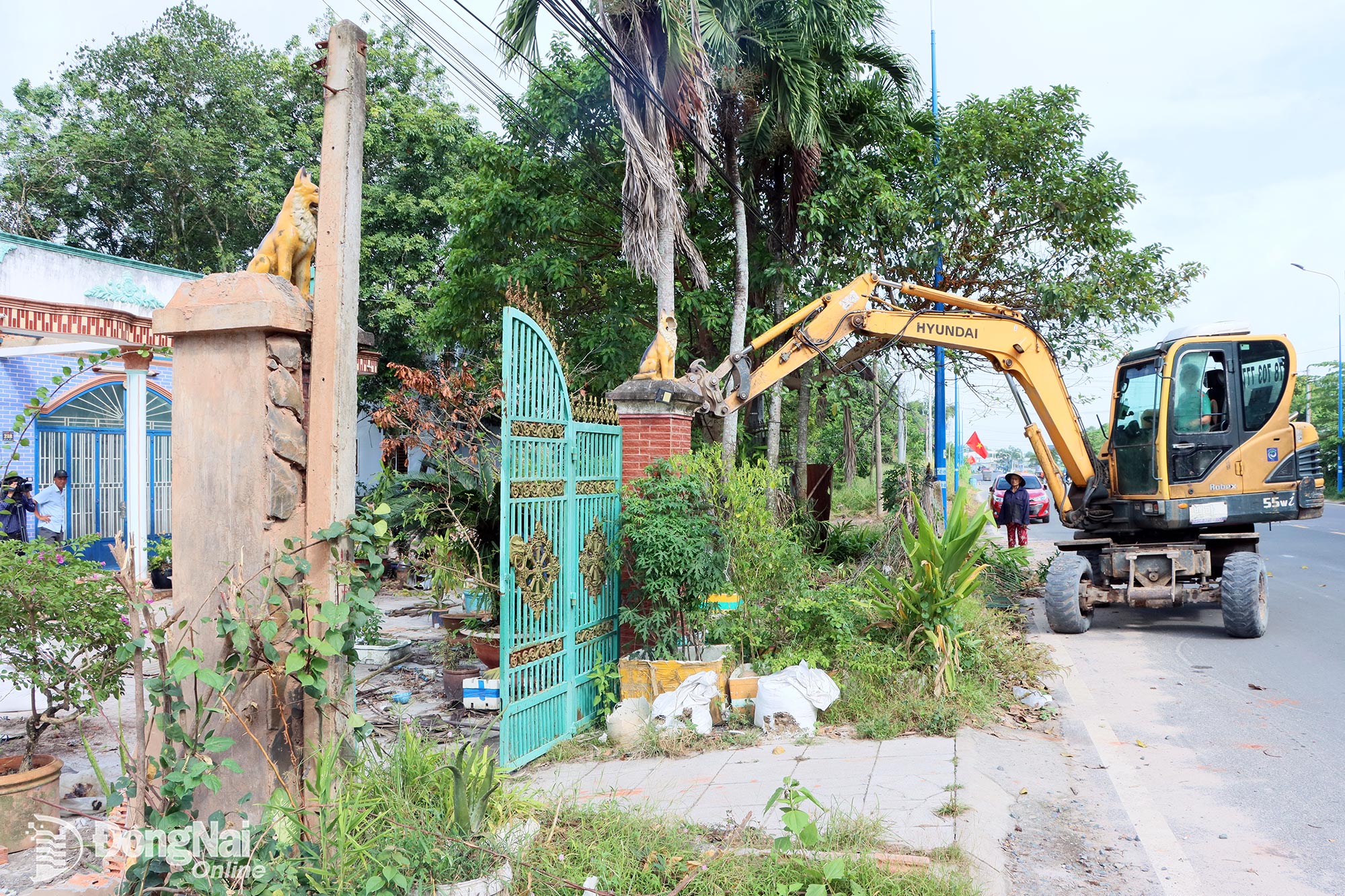 |
| Residents voluntarily dismantle structures to hand over the site for the Gia Nghia - Chon Thanh Expressway project. Photo: Xuan Tuc |
Chon Thanh ward has an industrial base, land available for urban development and a strategic position at the intersection of major transport routes. These advantages will create value only if land-use planning, connecting infrastructure and the list of projects are developed in a coordinated manner. The development of industrial parks without adequate housing, services, schools, healthcare facilities and intra-regional transport will increase pressure on the urban area. Land fragmentation and inefficient land use can also make it difficult for the ward to develop a center with clearly defined functions.
Nguyen Anh Tai, Chairman of the Chon Thanh ward People's Committee, said the area still had considerable room and advantages for development, including major transport routes and expressway projects currently under simultaneous construction. These conditions allow the ward to review its planning, attract investment and accelerate urban development. His assessment also highlights the immediate task for local authorities: rather than waiting for transport projects to be completed, they need to proactively identify development areas, land reserves for social infrastructure and priority projects.
Planning must precede projects
While Chon Thanh has advantages as a gateway and industrial center, Nha Bich has room to develop urban, service and ecological functions. In addition to the two expressways, the commune is home to Phuoc Hoa Reservoir, which has a water surface area of more than 2,000 hectares. This is a major resource, but it also requires strict protection of water sources and the environment, as well as careful management of safety corridors and infrastructure capacity.
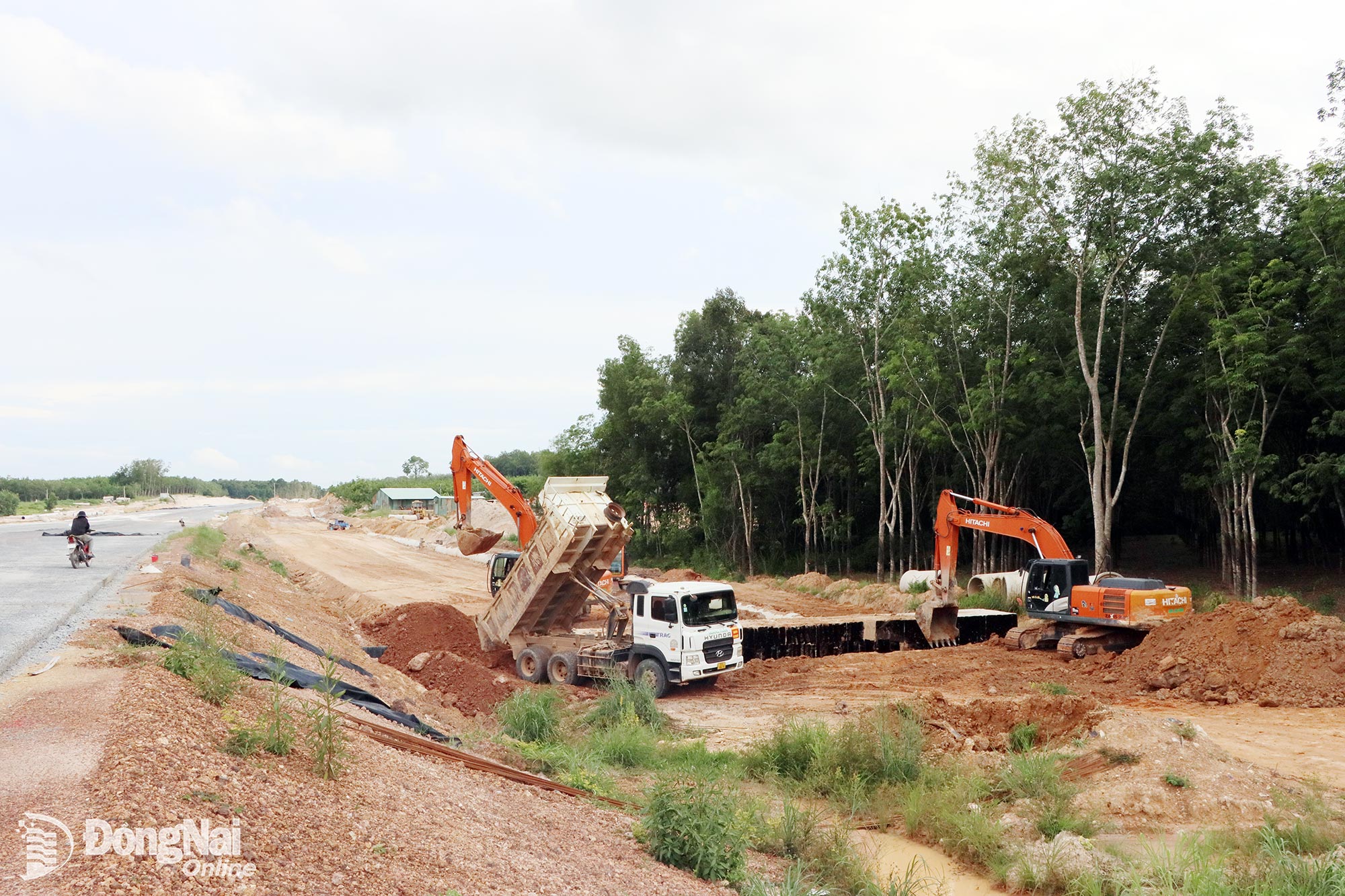 |
| The contractor works on a frontage road along the Ho Chi Minh City - Thu Dau Mot - Chon Thanh Expressway. Photo: XT |
For 2026-2030, Nha Bich commune has proposed attracting investment in nine areas, focusing on transport; urban, service and ecotourism development; complexes combining golf courses, urban areas and commercial facilities; and industrial park projects, among others. From proposals to implementation, however, the locality must continue to review their conformity with the city's planning, identify available resources, select investors and meet requirements related to land, the environment and infrastructure.
Dang Quoc Hung, Vice Chairman of the Nha Bich commune People's Committee, said the commune had reviewed key projects and proposed that the city accelerate their implementation, with some projects already included in previous planning documents. The locality wants the projects to be implemented soon to create conditions for socio-economic development. This practical requirement means Resolution No. 16 must be translated into a clear process: Which projects should be prioritized? Which agencies will be responsible for? What are the timelines for investment preparation? And which infrastructure must be developed first?
The land resources in Northern Dong Nai also underscore the need to prevent speculation and uncontrolled development. Once information on planning, expressways and new functional areas is released, land prices may fluctuate, transactions may increase, and changes in land-use purposes may become more complicated. If management is not strict enough, site-clearance costs could rise, land bank for public infrastructure could shrink and project implementation could be delayed. Public disclosure of planning information, digitization of land data, control of land subdivision and settlement against slow-moving projects must therefore go hand in hand with investment promotion.
According to Bui Xuan Thong, Member of the City Party Committee and full-time Deputy Head of the Dong Nai City Delegation of National Assembly's deputies, the Northern part of the city still has substantial land resources and is linked to an economic corridor for border trade and logistics with Cambodia and ASEAN. If the city makes effective use of new mechanisms and orientations, it can expand its development space while forming strategic economic corridors in the years ahead.
Resolution No. 16 sets out a long-term development direction for Dong Nai, with the Northern area playing a distinct role in regional connectivity and border trade. Whether these goals are achieved will depend on the progress of expressway projects, the quality of planning, the effectiveness of projects and discipline in land management. For Chon Thanh, Nha Bich and other localities, the immediate priority is to translate these orientations into concrete plans, with clear timelines, resources and responsibilities for implementation.
By X.Tuc, T.Minh – Translated by M.Nguyet, Thu Ha

Thông tin bạn đọc
Đóng Lưu thông tin