
With the aim of creating additional corridors and connectivity axes for spatial development, the draft dossier for the adjustment of the Bien Hoa master urban plan up to 2045 will include plans to expand and newly build a series of transport axes connecting along the North-South and East-West directions.
According to this draft adjustment, the transport infrastructure of Dong Nai City's central urban core will expand and connect numerous routes, creating favorable conditions for residents and enterprises to commute and transport freight.
Insufficient capacity and limited connectivity
Bui Van Hoa Street is nearly 6km long, starting at its intersection with National Highway 1 and ending at the Gate 11 Intersection. It is a transport route connecting several industrial parks in the Bien Hoa urban area with National Highways 1 and 51.
Bui Van Hoa Street stands as a vital North-South connecting transport axis for Bien Hoa. However, the current roadway width of this route spans only 12 to 15 meters. Due to the narrow road and high vehicle density, gridlock and traffic congestion occur routinely on this route, particularly during peak hours.
 |
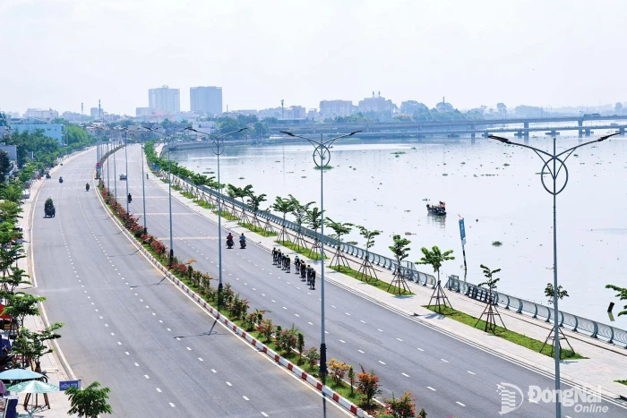
| A roadway currently under construction within the Tran Bien Ward area. |
Alongside Bui Van Hoa Street, National Highway 51 serves as the second North-South connecting axis for Bien Hoa. Much like Bui Van Hoa Street, National Highway 51 is a transit route that frequently experiences severe gridlocks and traffic jams.
Nguyen Phong, a resident of Tran Bien Ward, shared that during peak hours, traveling on National Highway 51 from the Vung Tau Intersection to the Son Tien Tourist Area is a genuine "nightmare." "The distance is short, but during peak hours, the traffic volume is overwhelming, the road is degraded, and it is narrow, making commuting exceptionally difficult," Nguyen Phong stated.
Along the east-west axis, Bien Hoa currently relies on three main routes: Nguyen Ai Quoc Street, National Highway 1, and Vo Nguyen Giap Street. While congestion on these routes is generally less severe than on the North-South corridors, their current scale is insufficient to meet the growing demands of urban mobility. Traffic bottlenecks are particularly common at major intersections such as Gate 11 on Vo Nguyen Giap Road and Vung Tau Intersection on National Highway 1, where traffic volumes frequently exceed capacity.
With a population of more than one million residents and its strategic role as a gateway connecting Dong Nai with Ho Chi Minh City, the Bien Hoa urban area’s transportation system is under increasing pressure. Having only five principal North-South and East-West corridors is considered inadequate for future development needs. Moreover, the relatively narrow roadways are required to accommodate substantial traffic volumes, exposing significant limitations in their carrying capacity.
Ho Van Ha, City Party Committee Member and Vice Chairman of the City People's Committee, noted that major gateway roads such as Bui Van Hoa Street and Nguyen Ai Quoc Street are currently too narrow to meet the city’s development needs.
Expanding and building strategic transportation corridors
Given the current situation of “too many vehicles, too little road space,” expanding existing roads and constructing new strategic transportation corridors has become essential.
Therefore, in the draft dossier for the adjustment of the Bien Hoa master urban plan up to 2045, which is currently being finalized, many new transport routes along the North-South and East-West axes are also being planned for investment and new construction, alongside plans to expand existing roads.
According to Nguyen Phong An, Deputy Director of the Department of Construction, for the three existing routes, Nguyen Ai Quoc Street, National Highway 1 and Vo Nguyen Giap Road, which form part of the East-West connectivity axis, the revised plan calls for Nguyen Ai Quoc Street to be widened to 55 meters along its entire length, extending from Bien Hoa Ward to the Hanoi Parish area in Long Binh Ward.
In addition, Route 768B will be added, passing through Tan Trieu and Trang Dai wards in the northern sector. Another route will connect the Aqua City Urban Area to the Long Hung - Phuoc Tan Road, then link to the specialized road for construction material transport to the Trang Bom urban sector. A further route will run from Long Hung Bridge through Tam Phuoc Ward and connect to the northern part of the Long Thanh urban area.
For the North-South axis, of the two existing routes, Bui Van Hoa Street and National Highway 51, Bui Van Hoa Street will be planned for investment in expansion.
The proposed adjustment to the Bien Hoa Urban Master Plan covers more than 26,300 hectares and has a projected population of 1.2 million. The planning area includes the entirety of seven wards: Bien Hoa, Tran Bien, Tam Hiep, Long Binh, Long Hung, Phuoc Tan, Tam Phuoc and a portion of 3 wards: Trang Dai, excluding the former Thien Tan Commune of Vinh Cuu District; Ho Nai, excluding Ho Nai 3 Commune of the former Trang Bom District; Tan Trieu, excluding the communes of Tan Binh, Binh Loi, and Thanh Phu of the former Vinh Cuu District.
Apart from the two aforementioned routes, the master plan also positions additional new connecting axes, including: two riverside roads along the Dong Nai River in the Bien Hoa Ward area and extending from Tran Bien Ward down to Long Hung and Tam Phuoc wards; and a brand-new road opened from the end of the Amata Industrial Park connecting to Vo Nguyen Giap Street.
Notably, along the North-South axis, the main route, with a 60-meter right-of-way width, will serve as the primary connecting route along this axis, providing a direct link from the center of the Bien Hoa urban area to the main gateway of Long Thanh International Airport.
The route would begin at Vuon Mit Intersection, connect to Thong Nhat Bridge, pass through Hiep Hoa Islet via the Bien Hoa City Central Axis Road, traverse the Bien Hoa 1 and Bien Hoa 2 Industrial Parks, run alongside National Highway 51, and continue directly to the Bien Hoa Airport gateway.
According to Nguyen Phong An, the transportation framework in the revised plan clearly identifies the city’s primary corridors, creates new development axes, and strengthens spatial connectivity throughout Bien Hoa’s urban area.
By Pham Tung – Translated by Mai Nga, Minho


Thông tin bạn đọc
Đóng Lưu thông tin